If you’re playing Ingress and are submitting new portals you’ll want to increase your chances of them being accepted. Here’s one way to increase your chances…
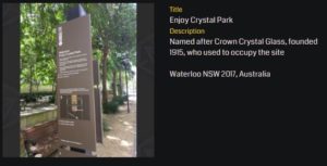
Let’s say I wanted to submit this portal:
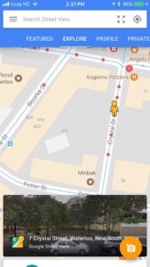 I’d want to open up Google’s Streetview app on my phone and see what Streetview images already exist and see if the portal is visible.
When you open the app, click on Explore then click on the current location icon in the address bar.
That will show you a map with red dots on it, these are images taken by the Google Streetview photographers or by people like you and me.
Click on the closest red dot and you’ll see the photosphere for that location.
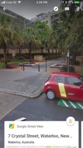 Check out the image and see if your portal is visible and clear enough for the OPR reviewers.
If it is, cool, nothing more to do.
If it isn’t, then increase your chances of acceptance by creating an up to date photosphere.
Creating a Photosphere
Fire up the Google Streetview App on your phone (Android and iOS) – for my examples I’m using iOS but the process will be similar.
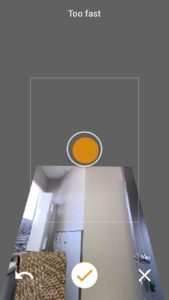 Click the Camera icon in the app and then Camera again (to specify the source of the image).
You’ll see straight away that there’s an orange circle in the middle of your screen. Hold your phone steady and the image will be captured automatically.
Find the next orange circle, hold steady, and repeat until the orange tick at the bottom of the screen turns green.
Click the green tick and you’ve finished the first step.
The app will do it’s think stitching together the images into something usable.
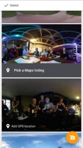 Now you need to pick a maps listing (or add GPS but probably not) to confirm your location.
Most people have upload set to wifi only, so you can close the app now.
When you get back onto wifi select the image and tap “Publish to Google Maps”
Your image may take up to 24 hours to go live but once it does it’ll be available in OPR for agents to use when reviewing your portal submission.
Be First to Comment